When someone talks about geographical information systems (GIS), the first thing that comes to mind is a map. Although this is a primary deliverable, a quick look around the country shows that fire and emergency service providers that use these data take them beyond the traditional map to true operational intelligence. This developing form of operational intelligence provides detailed situational awareness, enhances risk analysis/planning, creates public-facing performance dashboards and improves how departments communicate with the public.
With so many options to pursue, it can be difficult for departments to pick a place to begin. However, the growing community of public safety GIS analysts is creating workgroups and consortiums to help to lift each other to new heights. To help to start your journey, some of the emerging trends are explored below as are highlights of some progressive departments that are raising the bar with GIS technology.
Emerging public safety GIS trends
Trends in the public safety GIS industry show a pattern of interoperable platforms, integration between systems, capability to incorporate a growing variety of data sources, standardization of fire and emergency service analytics, and use of generative artificial intelligence (AI) to aid in geospatial analysis. Although not directly related to GIS technology, a discussion of interoperable platforms is important, because it might be a good place for departments to start a GIS program.
People and tools
When selecting highly specialized people, such as GIS analysts, it’s a little uncertain what should be sought in a new hire. Luckily, experts are working on NFPA 1022: Standards for Fire and Emergency Services Analyst Professional Qualifications. This proposed standard will help to outline and standardize several of the analyst roles and can be a great foundation by which to build a job description. It also might be a useful resource to establish career progression plans for GIS personnel who look to enter the public safety realm.
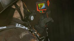
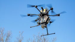
After finding the right people, you must find the right tools. Thanks in part to the International Association of Fire Chiefs’ (IAFC) Technology Council, nearly every tool is being guided to ensure that it interfaces or is interoperable with other platforms. One- or two-w ay connectivity with dispatch systems, integration with records-management systems and even tapping into existing sources of data, such as traffic cameras and drones, are creating multifaceted and real-time single interfaces for crews to use on responses. What is truly inspiring is how easily this level of detail can be used to create public-facing interfaces to help to keep the public safe and informed on the status of their department. These new forms of communicating before, during and after major incidents are improving public safety and establishing new efficiencies to ease the ever-increasing number and scale of incidents.
AI
Generative AI is a trend that can’t be ignored. Advancements are related directly to the efforts to create early-warning and early-intervention systems for wildfires. AI also is using the growing number of Internet of Things (IoT) sensors and smart-city concepts to provide management action points for local responders.
Imagine a jurisdictionwide detection system that no longer needs someone to call 9-1-1 to initiate a call for service. The sensors answer the question of what’s happening, while the GIS systems show where the issue is occurring. In communities that lack GIS professionals or resources to hire personnel, AI solutions offer affordable options to capitalize on the advancements in technology.
San Bernardino County
The San Bernardino County, CA, Fire Protection District serves more than 60 communities and spans 19,200 square miles. This community has experienced major flooding, wildfires and winter storms that created unique challenges for a department that serves millions of people.
Although the fire and emergency service personnel were truly heroic throughout these major incidents, the use of GIS tools was hailed as a new era of coordinating resources over a vast geographic area. From establishing baseline operational situational awareness to providing invaluable data for the after-action report, GIS tools provided a universal language to keep responders safe. Erin Opliger, who is the special projects leader for the department, describes her role as giving crews another level of situational awareness.
Mainly using Esri tools, such as ArcGIS, Survey123, StoryMaps and the 24/7 disaster response program, the department polled residents, created interactive maps for responders and residents, and engaged with the community. In some instances, the department even pulled sensor data and aerial imagery from aircraft to enhance situational awareness for the crews.
Beyond incident responses, the department is heavily invested in preplanning, particularly in the wildland urban interfaces (WUI), bringing a new level of detail to community risk reduction efforts.
That investment in technology is to help first responders get a clearer picture of the hazards that they face while also creating meaningful community engagement.
Boise
The Boise, ID, Fire Department (BFD) serves 300,000 residents within a 130-sq.-mi. jurisdiction. The department’s GIS projects are creating tools for not only responders but for the community as well.
BFD Technology Manager Joanna Zibbell has several traditional GIS projects and programs to help to guide the department leadership. Two stand out as awesome partnerships. (The BFD uses Esri tools but also invests in Avenza Systems to provide tools that are available when offline.)

As is the case with many department jurisdictions that have a major waterway, the BFD’s previous efforts consisted of its dive team documenting the waterway to aid in rescues. However, the information mainly was passed on between shifts through oral reports and wasn’t available to the public. “Float the Boise” is a community-focused project and collaborative effort between the BFD, the Boise Parks Department and Ada County Parks & Waterways. It generated an interactive map that shows permanent hazards (e.g., bridge pilons) along with areas that have poison ivy along the banks and other such issues—essentially, a tool to help people to enjoy this recreational activity as safely as possible.
The second project is a partnership with the Western Fire Chiefs Association and National Institute of Standards and Technology that will develop detailed preplans from visual mapping technology. Indoor/outdoor scans of Boise will be used to train analysis models to generate floor plans with preplan features. These scans can be used as traditional preplans or could evolve to power augmented-reality uses. In any case, tools to help first responders improve situational awareness are exciting.
ROI
Whether your department has embraced GIS technology fully or is looking to start a program, interoperable platforms are sure to make the journey easier and improve the return on investment. GIS is creating operational intelligence that can improve operations and save lives.