Throughout my career as a firefighter/paramedic, I trained and prepared extensively to respond to a variety of incidents. Later, as a fire chief and an emergency management coordinator, I prepared to coordinate and facilitate incident response at a broader level.
No matter the incident or my role, having enough actionable data and information to make the right incident action plan was a challenge. I sought tools, techniques and technology that would make my crews better informed for efficient and safe operations.
For me, drone technology and its associated tools and tactics became one of the most significant advances for this information-gathering on incident response.
Although the adoption of this technology by public safety has been rapid, many questions still surround the use of drone technology in incident response and decision-making, for example: What tactics and techniques exist for utilizing drones on incidents? What tools can be used in information-gathering? How do you analyze and act upon data? Of increasing importance, how do we better maintain aircraft? Answers to these questions will continue to evolve as the technology continues to improve.
Tactics and techniques
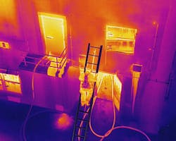
Through drone technology, we now have tools that enhance our situational awareness in the field. Standard aerial imagery enhances the initial scene size-up for crews at structure fires, wildland fires, rescue situations and hazmat incidents. Aerial thermal-imaging cameras help to: improve missing-person searches; find lost victims faster and increase their chances of survival; and mitigate risks to the boots on the ground (drones can be sent ahead of search parties, go to more dangerous areas and keep search parties away from cliffs or other potentially dangerous areas).
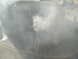
Traditional methods of determining a building fire’s location, size and movement often are based on education and experience, such as reading smoke techniques. Standard aerial imagery and aerial thermal imaging can help to provide this information far more quickly and with greater accuracy.
All that said, it’s extremely important to remember that this technology never should replace current strategies and tactics. We should continue to obtain a “hot lap” on building fires and use drones afterward to aid with monitoring changes in conditions. The ground level view and detail are crucial; the aerial view and details only increase this information-gathering capability. Drones help to enhance situational awareness, but they don’t give you those all-important firsthand sights or sounds that provide valuable information for decision-making.
In the same vein, drones that are used on wildland fires shouldn’t replace a safety spotter for wildland crews. Drones should be used as an aid for maintaining a visual on weather and fire conditions as well as for monitoring crews, including to guide them through safe routes to escape zones if need be. Of course, these operations should be coordinated with manned aviation assets per department policies and training that’s developed prior to drone use on actual incidents.
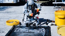
During a hazmat incident, monitoring can be accomplished in several ways, such as placard location and identification as well as gas detection. Remember, once a drone enters the hot zone, it must have an alternate landing zone with someone who is dressed in appropriate PPE and is trained to change batteries, swap sensors and equipment and charge batteries. Proper decontamination procedures of the drone and its equipment upon completion of the incident must be followed.
The key to utilizing this technology on any incident is, as always, proper training. Every incident that was mentioned above requires the ability of the pilot to fly in challenging conditions. True, sophisticated thermal and zoom cameras and aircraft-collision-avoidance sensors are available, but those functions don’t diminish the skill that’s necessary of a pilot to fly in close proximity to objects and terrain to obtain an adequate view or sensor reading. Furthermore, skills for emergencies (remote landing, loss of aircraft GPS signal in high winds, loss of camera signal, etc.) should be planned and prepared for.
Firefighters and incident commanders (ICs) always must remember that drones are technology, and technology isn’t foolproof. Sometimes, technology will fail or be unavailable for various reasons—perhaps when you need it the most. This is why maintenance should be conducted vigilantly and why usual strategies and tactics should be continued.
Information-gathering
One of the ways that I used drones for situational awareness and safety on fires was to afford myself and the incident safety officer the view of personnel and conditions of the entire incident. I placed my aircraft on the opposite side of the fire from my command post.
Thermal imaging gave me the ability to see heating of structural members in a roof to determine fire involvement in an attic and failure potential. During overhaul, we utilized the thermal imagery to locate smoldering hot spots and, thus, guide crews directly to them for extinguishment, which decreased drastically the time on scene.
On wildland fires, I utilized the aircraft to monitor the location and direction of the fire, to find and locate threatened structures, and to monitor crews’ progress and safety. Thermal imagery after the fire helped to find hot spots along the perimeter and to secure the fire line.
One of the most recent developments in drone technology is the capability to obtain aerial imagery for 3D and orthomosaic mapping. The latter became a valuable tool in pre-incident planning, tornado damage assessment and crime-scene mapping for law enforcement. (An orthomosaic map is an aerial photograph that’s geometrically corrected, such that the scale is uniform; in other words, the photo has the same lack of distortion as a map.) The capability to quickly map an area and to create a 3D model was invaluable for damage-assessment missions after the wildland fires that ravaged California in 2018 and after the tornadoes that struck Dallas in October 2019. Since then, software vendors significantly improved this functionality by facilitating the processing of captured imagery into a user-friendly map. Fortunately, aircraft that provide this capability are available at relatively low cost.Analyzing and acting on data
Analyzing the data that’s obtained from a drone can be performed in numerous ways. Most often, it’s simply a matter of viewing a live feed of the imagery during the active incident and using the visuals to make tactical decisions. Discovering that an overturned rail car is leaking—as well as noting the placard of the vessel—helps in rapid decision-making and unit assignments.
Other data analysis can be more complex. As mentioned above, mapping can help to determine areas of greater damage in a disaster, such as a tornado. During the Dallas event, mapping of a wide area was able to be conducted extremely quickly. This information was then fed back to the incident command post; in several instances, the information aided in the shifting of assignments from less damaged areas to others that, previously unknown to the IC, suffered more significant damage.
In the California wildland fires, areas of damage were mapped and analyzed to help to determine search areas for victims. These missions were aided by adaptive-learning, artificial intelligence software. As areas were overflown, the software analyzed and identified damaged buildings and vehicles, outlining areas to be focused on for search efforts.
Aircraft maintenance
Recently, aircraft maintenance has become a topic of importance. The relative ease of use during the actual flight of a drone sometimes gives a false impression of what a drone program involves. The sophistication of the operations of an aircraft and its equipment, as well as fleet size, often necessitates a program manager who has the time that’s necessary to ensure that the aircraft is up to date and airworthy.
Software updates can require significant time to perform and sometimes can create issues and challenges that require extra time to resolve. (Software updates are extremely important, because they might be needed to enhance features of camera systems or aircraft performance.) When multiple aircraft are involved, it becomes apparent that diligence and patience is an important attribute of a program manager.
Battery maintenance is another significant area of importance. The sophistication of aircraft batteries varies by manufacturer and type. Ensuring that batteries are kept in a state of readiness is crucial, because battery degradation can be a failure point in an aircraft operation.
Then there’s aircraft propellers. Leading edges of propellers should be inspected for damage after each mission, at a minimum—more frequently during long aircraft operations that involve multiple flights. Props that have damaged leading edges or looseness at their mounting hub should be replaced. Next to batteries and pilot error, propellers are one of the most significant points of failure.
These and other inspection procedures must be documented to be in compliance with the Federal Aviation Administration. Documentation will be demanded by the National Transportation Safety Board in the event of a reportable accident.
Time that’s spent on preflight and postflight inspections will reduce greatly the chances for an incident that could cause equipment damage or harm to personnel or civilians who are on the ground.
It’s likely that we will see many more uses of drones, as innovators in public-safety drone use push the capabilities of the aircraft’s technology.
Wayne Baker will present “Use of Drones on Emergency Incidents” at Firehouse Expo. To register, visit firehouseexpo.com.
Drones and COVID-19
W e’re seeing a rush to find uses for drones in conjunction with the response to COVID-19, such as employing a drone that has a loudspeaker attachment to monitor and, if necessary, to disperse gatherings of large numbers of people. Drones also are utilized to communicate with potentially infected patients prior to approaching, to give instructions and to gather information. Both cases help to distance responders and, thus, to reduce exposure, which helps to reduce the strain that the virus could pose to our response systems.
About the Author
Wayne Baker
Wayne Baker is a 26-year veteran of the fire service. He recently retired after serving for 10 years as the fire chief and emergency management coordinator for Joshua, TX. Baker currently is director of public safety integration for DJI, which is an expert in drones and aerial-imaging technology. Throughout his career, Baker consistently sought new technology that could save the lives of the public as well as public safety personnel. Over the past five years, he operated unmanned aircraft systems, or UAS, in regard to numerous fires, rescues incidents, law-enforcement operations and disaster response operations. Baker is a founding member of the North Central Texas Public Safety UAS Response Team (PSURT), with whom he deployed to such disasters as Hurricane Harvey and, most recently, the Dallas tornado incident of Oct. 20, 2019.


