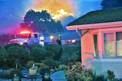
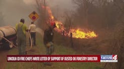
Fire personnel across the entire nation are responding to an alarming trend of increasing vegetation fires in the wildland/urban interface (WUI). These incidents are immensely destructive, as evidenced by the 2017 and 2018 fire season incidents setting records and then breaking them in less than 12 months.
WUI operations place suppression personnel in a volatile and dangerous environment with little time to make decisions. The rapid sorting of structures into categories based on defensibility, also known as triage, is arguably one of the most challenging tasks facing firefighters in the WUI. Triage is often performed in a hostile and time-compressed situation that demands a thoughtful predetermined method to sort the threatened structures and help determine which tactical action is appropriate for each.
3 categories
When firefighters apply effective and objective techniques during triage, time and energy isn’t wasted. When performed systematically, firefighters will have increased confidence that an appropriate decision has been reached, and limited suppression resources are dedicated to the objectives with the highest chance of success. The goal is to thoughtfully and systematically place each structure into one of the following categories: not threatened, threatened defensible or threatened non-defensible.
Not threatened
A structure that is not threatened is either out of the path of the fire front or its construction or clearance status is such that there is no threat, even if the fire front affects the immediate area. These structures have more than adequate clearance of flammable vegetation and are constructed entirely of fire safe materials. However, do not ignore these structures. A periodic check of the structure should be part of the structure defense plan.
Threatened defensible
For this category, an adequate safety zone or temporary refuge area exists, but there is a high probability that the structure will be damaged or destroyed without some intervention by suppression resources. Structures in this category typically have some degree of clearance from surrounding fuels and may exhibit limited fire safe construction features.
Fire department interventions may include removing fuels, closing windows, covering vents, and applying foams or gels. Intervention may require that fire department resources remain at the structure during the fire front impact. Often the residents have evacuated, but if they elect to stay, crews must ensure that they understand the situation and are prepared to shelter in place.
In some situations, structures considered threatened but defensible may be downgraded into the non-defensible category if adequate time does not exist to perform the necessary intervention measures or fire behavior changes adversely.
Threatened non-defensible
For this category, an adequate escape route to a safety zone or a temporary refuge area does not exist, and based upon current and forecasted fire behavior, the structure cannot be safely defended. Structures in this category typically have little or no clearance from surrounding fuels and exhibit limited or no fire-safe construction features. The structure may be located mid-slope or in another dangerous topographical feature, such as a chimney, saddle or drainage. Crews should evacuate residents from structures that are threatened but non-defensible.
Structure triage analysis points
Assuming that firefighter safety considerations have already been analyzed and sufficient escape routes, safety zones or temporary refuge areas are readily available, the triage process can begin.
Top-down triage is the systematic analysis of all factors in a WUI fire that contribute to the potential threat to a structure visualized and processed from the sky down to the ground. This approach ties together numerous concepts and provides a systematic analysis of the structure and the surrounding ignition zone to aid in the rapid sorting of structures. Triage must be completed without hesitation, as fire progression in the WUI does not often afford us the luxury of time. This triage method brings focus and confidence that all structures are analyzed with specific criteria and in a consistent manner.
Smoke/sky
Start by reading the smoke. Observe the color, density, definition, direction and amount of rise of the smoke column to help you determine not only the fuel type but also the atmospheric and wind conditions. Where is the smoke column going? How is it behaving? Where are the embers going to fall?
If there is no visible smoke in your area, then look to the clouds. Observing the cloud shape and movement, you can begin to estimate the fire’s current potential. You cannot safely commit to structure defense, even with defensible space and favorable construction, if the indicators of the fire’s potential places you in the path of the proverbial “freight train.”
Overhead fuels
Look at the amount of fuels present not only directly above the structure, but also the aerial fuels in the surrounding area. Fuel arrangement and continuity in the aerial fuels can be just as problematic as fuels on the surface. With the right combination of overhead fuels and a weather forecast that identifies potential fire movement, the house may not be a safe location. Few structures can survive a direct hit by a sustained crown run, so be able to recognize the potential for this event.
Roof
The roof of a structure in the WUI is its first line of defense. The type of roofing material is the most critical, but also important is the shape of the roof. Note the number of valleys and the pitch steepness to help determine where dead and dry vegetation debris accumulates. As wind currents flow over and around structures, natural eddies are formed and are responsible for depositing this debris in certain locations. These locations are where embers will also be deposited. Remember, it is not the direct flaming front that impacts and destroys the structures, it is the ember shower produced by the fire. Ember showers transport and deposit embers in distant locations, remain undetected, and then grow to consume structures.
Gutters
Gutters—or specifically the amount of vegetation material they harbor—are a critical piece of information when triaging. Fire can quickly become seated in the prime location of a gutter and burn undetected until it involves most of the roof and attic. A couple of short bursts of water, literally a few gallons above the gutters, will be effective in dampening the fuels present and changing them from receptive to unreceptive.
Eves and soffits
The eves are a significant heat trap and collection point for ember turbulence during a fire’s approach to a structure. The pathway is usually the attic vents. As embers are blown in, detection of fire presence in the attic is nearly impossible due to drift smoke until it is well established. A thermal imaging camera can aid in the detection of heat both inside and outside of the attic. The presence of enclosed soffits or small-diameter screens over vents can greatly improve the structure’s survivability.
Siding
Like the roof, siding materials have different strengths and weaknesses. The more likely fire will walk up the siding, the lower the chances for the structure to survive alone. Note the number, placement, construction materials, and privacy coverings of the windows and doors within the various walls. Much like how skylights weaken the roof, windows and doors weaken the walls. Once these features fail, fire will enter the structure and quickly involve interior contents.
Also, note any heat traps around the structure. Decks and exposed crawl spaces are examples of problematic heat traps. Much like the attic, these areas can become perfect areas to trap embers and, with the available fuel, create hidden fires that are not discovered until the house has deep-seated fire.
Surface fuels
Generally, your initial observations during triage will be the fuels directly adjacent to the structure. This almost automatic response is logical because these fuels provide the fire’s best access to the structure. Some key factors to identify include:
- Fuel arrangement—the orientation of the predominant fuels is either vertical or horizontal
- Continuity—describes the fuels being patchy or continuous in the vertical and horizontal dimension
- Moisture content—live and/or dead fuel moisture percentage, known or calculated
- Size—the surface area to volume ratio of the predominate fuels
- Class—determines the categories of fuels in (e.g., 1-, 10-, 100- or 1,000-hour)
- Volatility—the chemical compounds present that can influence fire behavior
- Age—new lush growth vs. old decadent growth
- Native or ornamental—whether the fuels have been augmented by additional materials present
- Loading—defined as how much is present expressed in tons/acre
- Density—high or low structural density of fuel particles
- Yard accumulation—the collection of items often found around a structure that are human-built
This area is also the circle of ignition potential and is used to determine the classic idea of defensible space. Do not forget, however, the simple things like the location of fences or landscaping features that provide flammable pathways to the structure.
Placement in the topography
The structure’s location in the greater topography needs to be given the most thoughtful analysis. Regardless of whether all previous steps of your triage were positive, if the structure is placed in a location such that the fire’s approach would decimate it, this structure is no place to stay.
Recognition of the topography is possibly the most difficult area of consideration for crews for several reasons: They may be unfamiliar with the area, it may be difficult to determine while operating at night, or they may have been given limited briefing information. Fortunately, recognition of topography can be accomplished in even the most unfamiliar country using inexpensive and readily available technologies, such as smartphone applications and handheld GPS systems. If a company officer intends to respond to and participate in wildland incidents outside of their familiar surroundings, they should consider acquiring one of these technologies to guide their decision-making.
Intuitive fire behavior analysis in unfamiliar topography has led to many injuries and fatalities during wildland fires. For a company officer to make successful triage and crew safety decisions, determination of the path of the fire’s approach is mandatory. If the approach is in full alignment with fuel, weather and topographic variables, and there is a complete lack of a safe refuge site, the structure defense assignment must be declined.
Final thoughts
These concepts are meant to assist any firefighter with the sometimes-daunting task of structure triage during an expanding WUI incident. In being familiar with this information and objective parameter of threat analysis, a firefighter can develop a systematic and reproducible technique for accomplishing the task of placing structures in the respective triage categories. When a systematic method is applied to this complex task of triage, fewer critical elements are missed, risk assessment is more accurate, and more timely decisions about personnel and crew safety can be made. Structure triage training translates into less stress at the incident and ideally more structures saved.
Todd McNeal
Todd McNeal is the chief of Twain Harte Fire in Tuolumne County, CA. McNeal is a member of a federal Type II Incident Management Team, serving as division/group supervisor for the last 13 years. McNeal holds numerous ICS qualifications in wildland operations is a registered State of California Fire Instructor, Fire Officer and Chief Fire Officer, and has a bachelor's degree in natural resources management.


