Like other cities, Nashville certainly is no stranger to natural disasters or tragedy. So, from large tornados to major floods, Nashville continues to adapt, plan and respond accordingly.
We’re no different than other cities in that we understand and, generally, are prepared for, let’s say, historically expected weather conditions that are precipitated by our location and our topography.
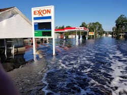
However, perhaps historically expected weather conditions aren’t the reality any longer. For the past several years, every time that we turn around, it seems as if there is flooding and flash flooding in areas of the country that typically don’t see it. It seems as if hurricanes that make landfall are larger and more powerful and contain more precipitation than those of the past.
With these events, countless agencies and departments might become inundated with flooding and fast-moving water and might face unfamiliar types of rescues with minimal-to-inappropriate PPE, a lack of equipment or inadequate staffing.
Large urban areas present unique challenges of their own, particularly if flooding events are rare or occur on a scale that previously is unseen. That’s why it’s important to discuss changing weather patterns, their effects on urban areas and the concerns that urban areas present to rescuers.
Trapped on an island
Thanks in part to technology, we often witness weather events unfold in real time, so we continually are bombarded with natural disasters somewhere in the United States and the world. According to National Oceanic and Atmospheric Administration’s most recent National Climate Assessment, the United States is seeing an increase in heavy, multiple-day precipitation events in areas east of the Rockies, including the Midwest, the Northeast and some parts of the Southeast. One theory for this: The presence of increased amounts of water vapor in the atmosphere is funneled up from the south from the eastern Pacific and the Gulf of Mexico. An increase in larger hurricanes that move inland at a slower pace that contain more precipitation might be the reason for increased precipitation in the fall months in the Southeast.
Urbanization of our landscape might be to blame partly, too—specifically, the formation of urban heat islands and their subsequent effects. An urban heat island (UHI) is a dome of accumulated heat over an urban or metropolitan area that’s much warmer than the surrounding area. This is caused by human manipulation of the land. Several studies show a marked increase in the formation or strengthening of storms that pass through urban areas that contain a UHI signature. A UHI signature also can cause a storm to completely bifurcate an area. In either case, increased precipitation attributed to UHIs often is seen downwind from them. (Many factors influence the development of UHIs, and not every urban area will develop one.)
To remind: For precipitation to occur, cooler air (low pressure) moves into an area and displaces warm, moist, unstable air (high pressure). The warm, moist, unstable air is pushed up into the atmosphere, where it changes into precipitation. (The temperature at the ground dictates the type of precipitation.)
When rain falls on an area, it’s absorbed by the soil and used by trees and surrounding vegetation to help to cool the area via evaporative processes. In a UHI, several factors occur simultaneously to interfere with this process. As a city expands outward, its soils and vegetation are removed and often replaced with asphalt, concrete or structures that are made from heat-absorbing materials. The heat that’s absorbed by these products is radiated to the surrounding area, most noticeably at night. The more of these materials present, the more heat that’s absorbed and then later given off. Automobile exhaust and heating/air conditioning units also can introduce warm air into the area.As cooler air moves into an area that has larger amounts of moist, warm air, the amount of precipitation increases, often downrange from the area that’s affected. As this increased amount of precipitation falls, there is less soil and vegetation to absorb the water, so there’s nowhere for it to go, or the drainage infrastructure that’s in place can’t keep up with the increased demand. This is particularly true if drains aren’t regularly maintained and cleared of debris. In some cases, the inability for water to be absorbed quickly results in faster flows of water in the drain systems or causes these flows to spill out, thereby overwhelming nearby areas. This creates the problem of a cyclical process in which the effects continually increase as urban areas expand.
Think about this for a second: Most cities, particularly larger urban cities, were founded on or near a river. As cities grew, so, too, did their dependence on these rivers for everything from domestic drinking water, to transportation, trade, agriculture, etc. As some cities increased at faster rates than others, the aforementioned problems with drainage occurred. Secondary and tertiary bodies of water, such as ditches, creeks and smaller tributaries, eventually drain into the primary river. Also, sometimes, structures are built on or near flood plains. So, when a heavy precipitation event occurs, flash flooding can occur and overwhelm the nearby tributaries and cause everything to back up.
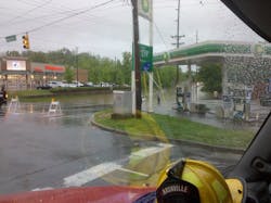
It’s important to note that in urban areas, flooding/flash flooding and swiftwater rescues usually go hand in hand. Flooding occurs when precipitation inundates an area long enough that the ground can no longer absorb water. Flash flooding occurs when the precipitation comes down faster than it can be absorbed. Urban areas obviously have a higher population density than their rural counterparts. Although rural areas can experience the same types of swiftwater-related situations that are found in urban areas, such as vehicles in water, pins, strainers, victim entrapments, flooding of structures, electrical hazards, etc., it’s important to note that the compounding of multiple types of these situations occurring simultaneously isn’t seen as often in rural areas as they are in urban settings. As rescuers, this gives us a lot to think about, particularly regarding rescuer and victim survival and the increased potential for rescuers to become victims themselves.
It happens quickly
Imagine an urban area that has very little natural vegetation that recently received a considerable amount of rain. A second system brings more heavy rain, but soils already are saturated to the point that they no longer can absorb water. The drainage system is overwhelmed. Creeks are swollen. Water now begins to back up—first, out of the bank, then into the drainage and sewer system. It starts inundating a heavily populated, low-lying area of town that has considerable vehicle traffic. Streets now are flooded with moving water, trapping victims in their vehicles and cutting off routes of travel. A nearby apartment complex takes water into the ground floor where handicapped persons are known to reside. The main entrance to the complex is a series of walkways that have 3-foot-high handrails on either side. Swift moving water now washes over the top of them, and an 8-foot-high chain-link fence sits only yards downstream. Within minutes, calls for help are pouring into 9-1-1—and it’s 2 a.m. Responders who operate in these conditions immediately face multiple enemies on several fronts. Triage/access to victims, victim exposure, danger to responders, darkness, downstream hazards and compromised points of entry/egress are a few of the obvious.
The not so obvious? Rescuers who find themselves having to enter the water face biological and etiological concerns from the sewage as well as potential chemical exposures. Wading rescuers must be cognizant of the underwater pulling effects of pressure differentials that are caused by submerged drains or open manholes, not to mention exposure to surface/subsurface electrical hazards. Chain-link fencing presents its own unique hazard as an incredibly dangerous strainer. Issues of limited equipment and short staffing compound these problems.These situations can overwhelm. Events unfold rapidly with little time for preparation. Within 30–40 minutes of such events, it isn’t uncommon for all assets to be actively engaged in rescues over a given area. When sizing up complicated scenarios such as these, it’s helpful to pause, slow down, take a deep breath. Pay attention and consult your situational awareness.
Rescuer safety is paramount. Remember, before any rescue is attempted, placement of an upstream spotter and downstream safeties must be ensured. Always have a backup plan—or as many as resources allow. Solutions to technical rescues often are the result of good judgment that’s based on past experiences and realistic scenario-based training. In most cases, the best solution is the simplest, safest and fastest.
In instances of flash flooding, the water often subsides as quickly as it rises. We should ask ourselves what’s the worst thing that could happen if we do nothing? Is the water rising or falling?
Look for areas above the waterline on solid surfaces, such as buildings or automobiles. If there is a wet area just above the waterline, then the water most likely is dropping. In large, multistory residential situations, consider having residents evacuate to a higher floor and shelter in place.
Planning for future similar scenarios could include the staging of equipment in various areas that are prone to flash flooding and employing the use of “area commands” within the incident command system. Also consider equipping boat teams with basic hand tools for cutting, prying or popping glass, as well as webbing, extra carabiners, throw ropes and extra personal flotation devices.
Rescuers should be made as visible as possible with reflective materials, chem lights or strobes and have reliable communications.
Decontamination of all equipment and persons exposed to the water should be conducted immediately or as soon as possible upon completion of the mission.
Just as in fighting fires, I always have believed that when conducting swiftwater rescues, basic skills accomplish the mission. There are incredible boats, gear, gadgets, etc., that make responding to these types of events easier on the rescuer, with some gear or watercraft arguably more ideal for applications in one area versus another. However, what good are these tools in the hands of the untrained or inexperienced? A solid foundation in the basics paired with realistic training provides the groundwork for teams to grow with the addition of new technology. For a fantastic read on differing equipment and application for urban areas, see Russell McCullar’s article, “Building an Urban Swiftwater Rescue Arsenal,” which appeared in the March 2019 issue of Firehouse Magazine (firehouse.com/21044973).
What else ya’ got?
I never made a “textbook” rescue. In fact, in the dynamic world of swiftwater rescue, the only thing that’s textbook is that they’re not. Because swiftwater rescue is a technical rescue that comprises concepts from rope rescue, surface rescue and extrication, teams should have resources that are at their disposal that might be outside of the box. Some legwork is required to get out and take stock of what’s available to a given department or agency.
One concept that I experienced firsthand is the use of highwater vehicles in the swiftwater environment. These usually are current or former military transport vehicles that are designed to operate in high water and limit the exposure of rescuers to the hazards of swiftwater. They have large payload areas for the transport of rescuers, equipment and victims and provide an incredibly stable platform for conducting rescues.
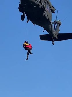
Aerial apparatus bring different lengths of ladders for “reach” capabilities as well as make great high-point anchors. State Helicopter Aquatic Rescue Teams (HARTs) are another invaluable resource. Although currently not in every state, there are several state teams in service. These teams comprise highly trained swiftwater and search-and-rescue technicians coupled with incredible military/state law enforcement aircraft, pilots and crews.
A new mindset
As instances become more common, swiftwater rescues in urban areas should be approached with simplicity, safety, expediency and solid fundamentals. However, common sense and good judgment should be utilized in every application, with rescuer/team safety being the priority. We can’t control the weather, but we can control how we prepare, train and respond to the problems that it creates. Just as our weather patterns seem to be changing, so, too, must our thought processes regarding response, training, planning and preparation, so we become as dynamic as the environment in which we operate.
About the Author
Brian Felts
Brian Felts is a 20-year veteran of the fire service, the past 15 years with the Nashville, TN, Fire Department 15. He has been involved in swiftwater rescue since 2002. He currently is assigned as an engineer/paramedic at Engine/Water Rescue 22. He has served as a primary swiftwater rescue instructor since 2012 and as an adjunct rope rescue instructor. Felts holds an associate degree in paramedic science and in fire science technology. He holds technician-level certifications in swiftwater rescue, rope rescue and hazardous materials. Felts' hurricane deployments include during Florence and Irma as part of USAR Team, Tennesse Task Force 2.


