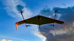
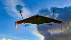
In 2019, drones have definitely become an integral part of the public safety landscape and to some, drones are now considered mission critical. Flashing back to 2015, drones had shown some progress but were still mired in strict Federal Aviation Administration (FAA) regulations. The use of drones was limited to early adopters, many of which already had aviation divisions for manned aircraft.
In 2016, the most important factor to enhance adoption was on the regulatory side when the FAA published new rules for both public agency flight (Certificate of Authorization or COA) and commercial flight (Part 107). Even after these regulatory changes, drones did not really start expanding throughout public safety until the catastrophic hurricanes in 2017. In addition to the hurricanes, other large natural disasters such as floods, tornados, wildland fires, earthquakes and volcanic eruptions would unequivocally prove the value of public safety drones.
In 2018, the Bard Center for the Study of the Drone published a report that over 900 public safety agencies in the United States had received an approved COA from the FAA. This report did not capture the entire data as there was no easy way to ascertain public safety agencies operating solely under Part 107 rules. For example, the Bard study had identified 26 public safety agencies that had COAs in Virginia. After additional research, I identified 26 additional agencies operating under Part 107. Based on Virginia’s data, it is clear that the reference to 900 COAs (while correct) is a very modest number of public safety agencies with drone programs nationally (COA and Part 107). Additionally, Virginia saw a growth from two public safety agencies with drone programs in 2016 to nearly 50 in 2018. A similar trend is occurring globally, and public safety is implementing drone programs at a much faster pace. This global trend is also illustrated by the many examples of growing European public safety agencies with drone programs and by the formation of the European Emergency Number Association Public Safety UAS Committee and the International Emergency Drone Organisation.Today, drones have gone from a handful of operations several years ago to many operations, especially any significant incident or event. There are many operational examples of actual public safety deployments such as, but not limited to, structural firefighting, wildland firefighting, hazardous materials incidents, incident safety overwatch, fire investigations, training operations, technical rescues, water rescues, shark shore patrol, lifeguard swimmer rescue, search and rescue, snow search patrol, law enforcement forensic investigations, tactical operations, active shooter/hostage situations, illegal hunting/poaching, civil unrest, large public assembly/event overwatch, floods, hurricanes, mudslides, tornados, earthquakes, volcanic activity, monitor critical infrastructure, damage assessments, water sampling, major traffic crashes, and traffic crash reconstruction.
It is difficult to provide specific statistics in totality on the impact of drones for lack of central data collection, but after the major disasters with thousands of unmanned flight missions and the more routinely occurring daily successes by public safety, it is reasonable to say that thousands of people have been saved or benefitted from the data received from drones. Throughout the hurricanes of 2017 (Harvey, Irma, Maria), the record wildland fires of 2018 in California, the volcanic eruptions in Hawaii in 2018, record floods in the Midwest and the Alabama tornado in 2019 drones have played an essential role by enhancing the safety and effectiveness of public safety operations. Drones provide an invaluable view from above to see hazards that may not be visible from the ground.
Catastrophic incidents
The catastrophic Carr Fire and Camp Fire in California resulted in an extensive number of drone flights from which drone imagery data was integrated into Esri’s ARCGIS, creating a dashboard that could provide geospatial “pins” to show fire activity in the form of drone images, Hangar 360 degree hi-res damage assessments, evacuation maps, Cal Fire structure status, before/after imagery and debris removal plans. This integration of data is then accessible by multiple agencies across jurisdictions. The Carr Fire Dashboard can be viewed at tinyurl.com/yajfwkud, while the Camp Fire Dashboard is available for viewing at tinyurl.com/yckkgy2k.
The volcanic activity in Hawaii provided invaluable information as to daily situational awareness of fissure activity, lava flow, damage assessments to property and sulfur dioxide sensors to identify areas that needed to be evacuated.
In March 2019, in Beauregard, AL, a tragic twister killed 23 and created a half-mile wide swathe of destruction. Access was severely limited as trees and debris blocked roads and complicated the search for victims. The area of damage was so vast, that there were not enough people to search on foot. Quickly drones provided eyes in the sky that could use both normal and thermal images to search for victims. Quoted in USA Today, Lee County, Alabama, Sheriff Jay Jones said, “It gave us an overhead view of areas that we might’ve missed had we been at eye level on land.”
Innovations with existing drones
South Manatee, FL, Fire and Rescue (SMFR) have been involved with extensive evaluation and deployment of drones for hazardous material incidents. Through their process they have found gas monitoring to be reliable to identify gaseous substances with sensors mounted on drones. SMFR also determined that use of a drone as an assessment tool could reduce the initial stage by an hour on average. Additionally, if their hazmat techs are operating in a hot zone, a drone can carry and drop a needed tool at a nearby location where the techs can grab it. Previously, a hazmat tech may have to walk a lengthy distance to obtain the tool and then return. And, of course, the drone can fly to maintain situational overwatch and use normal imagery or thermal imagery as needed. The thermal imagery gives additional value to hazmat situations as it can see the varying temperatures, which may indicate a fluid level in a container, visualize an invisible plume, identify hot spots and see spread of a spill over ground.
When it comes to video streaming via drone (or otherwise), there is exciting developments with KSI Data Sciences, which offers a video-streaming capability built on a military format that can adapt to varying bandwidths while maintaining resolution, low latency and address cybersecurity. The importance of maintaining high resolution and low latency cannot be overstated when it comes to high-risk tactical operations where being able to distinguish a weapon or a hazmat placard needs to occur in real time.
FAA regulatory changes
As part of the FAA regulatory changes, public agencies can receive a blanket COA which immediately allows for night-flight operations (with defined requirements) and flight over people within a controlled incident perimeter and can usually be issued in less than two weeks. There recently have been new developments directly as a result of the FAA Integration Pilot Projects (IPP) that have had a direct and positive impact on public safety operations. State Farm, operating with the Virginia IPP and the Mid Atlantic Aviation Partnership, was able to get one of the first waivers to fly over people and extended visual line of sight for four states (VA, NC, SC, GA) during Hurricane Michael to facilitate more rapid damage assessment.
On March 20, 2019, Inside Unmanned Systems reported that the police department in Chula Vista, CA, is now the first public safety organization allowed to regularly fly drones beyond the visual line of sight (BVLOS) of the drone’s pilot after the FAA granted it a waiver for such operations.
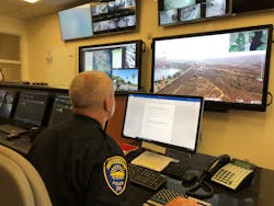
The Chula Vista Police Department (CVPD) has been testing and integrating unmanned aircraft into its activities since October 2018, conducting more than 300 flights in the process. That waiver of existing rules limiting the lengths of flights will enable the CVPD to send drones on emergency response calls over a 40-mile area as opposed to its previous 3-mile area.CVPD has implemented a program called “Drones as First Responders System” and immediately dispatches the drone at the initial dispatch from atop of a police station, remotely piloted from the dispatch center to the incident coordinates. By visualizing the scene, agencies can determine if more help is needed, if units may be freed up, and maintain video of scene activities until a response unit arrives. This provides a quicker overwatch of the incident scene and is designed to reduce response time, increase safety, efficiency, and accountability. The statistics from their website are impressive. Since September 2018, CVPD has deployed this program 356 times, assisted with 48 arrests, 43 occurrences avoided necessity of deploying ground units, a drone was first on scene 159 times with an average response time of 112 seconds when first on scene. Chula Vista is utilizing the CAPE technology (cape.com) with advanced sense and avoid technology.
Another emerging provider of similar technology concept is FirstiZ (firstiz.co), which is now working on a CAD integrated autonomous drone project, integrated with remote hazmat detection sensors as well as other payloads. From a fire service perspective, this type of program has a huge impact on not only response and mitigation, but also on the Community Risk Reduction Program.
Tethered drones & regulatory change
Tethered drones will also fall under new FAA rules as outlined in the FAA Reauthorization Act of 2018. which are defined by Congress as:
- Weighing 4.4 lbs. or less, including the payload but not the tether
- Being physically attached to a ground station with a persistently taut, load-rated, power-carrying tether cable
- Being controlled and retrieved by the ground station through physical manipulation of the tether
It is important to point out that the definition above does not include tethered UAS, which have passive tether cables attached to them but otherwise are piloted similarly to free-flying UAVs. The background of the Actively Tethered UAS definition is that intelligently and actively tethered UAS are fundamentally safer to use than passively tethered and traditional free-flying UAS; they are not piloted, they are manipulated via a persistently taut and load-rated tether cable from a ground station, and they are lightweight.
Fotokite systems is one of the exciting new technologies developed to actively use a reinforced ultra-thin, load-rated tether for precise localization near the ground (independent of GPS or other radio signals), for flight power, and for secure video downstream and control links. To my understanding, Fotokite systems uniquely fit the criteria defining Actively Tethered UAS today. Additionally, Fotokite recently announced that they had launched a new product for U.S. firefighters in partnership with Pierce Manufacturing. The press release stated that “Fotokite systems are actively tethered UAS built directly into public safety vehicles and firefighter operations to provide persistent aerial situational awareness and continuous incident safety overwatch with the single push of a button, no piloting necessary. These systems define a new product category available to first responders and have been specially designed and built from the ground up to help in public safety operations.”
The regulatory changes to tethered (actively taut) drones is a major development and benefit to the fire service and public safety in general. This means that fire service agencies may deploy a tethered drone immediately upon arrival and maintain a constant overwatch with hi-res imagery or thermal images and streaming of video directly to the incident commander (IC) or designee. The tethered drone can also fly continuously as the tether provides constant power. But what is even more important to know (when finally authorized by the FAA) is that a tethered drone will NOT require a remote pilot, can be launched by the push of one button and can fly in rain, snow and windy conditions.
Since 2016, the use of public safety drones has expanded greatly in number and application and it is clear that drones enhance safety and operational effectiveness. For ICs, this helps them identify hazards that they might not otherwise be aware of. So this question goes out to all the departments that are not utilizing drones (either your own, mutual aid or through a contract for service), “Would you ever place your citizens or firefighters in harm’s way unnecessarily?” and to follow up with another rhetorical question, “Aren’t you doing just that if not utilizing the information provided by a drone?” There is nothing more dangerous than not knowing about the hazards that you don’t know exist.

Charles Werner
CHARLES WERNER, who is a Firehouse contributing editor, is a 45-year veteran of public safety. He served with the Charlottesville, VA, Fire Department for 37 years, serving the past 10 years as chief. Following retirement, Werner served for two years as senior adviser and acting deputy state coordinator for the Virginia Department of Emergency Management. He has chaired: DHS SAFECOM Executive Committee; IAFC Technology Council; National Information Sharing Consortium; and DHS/White House Incident Management Information Sharing SubCommittee. Werner currently serves as the director of DroneResponders Public Safety Alliance, chair of the National Council on Public Safety UAS and chair of the Virginia Secure Commonwealth UAS Sub Panel.
