CAL FIRE Partners with RadioMobile on AVL Technology
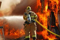
SAN DIEGO — (Dec. 17, 2019) – CAL FIRE, one of largest fire agencies in the United States, operates over 3,000 fire, emergency response and resource protection vehicles, as well as more than 50 aircraft—all with varying connectivity challenges. While many CAL FIRE areas of responsibility (AOR) have commercial carrier (4G/LTE) coverage, others are so remote that carrier-based communication is impossible. Incident command and management need to maintain seamless communications with their entire fleet of apparatus and multiple dispatch centers across 31 million acres of service area. They also require accountability of all resources at the scene of a fire and as they travel to and from and within incidents.
To solve their connectivity challenges, CAL FIRE partnered with San Diego-based RadioMobile to equip all frontline vehicles with automatic vehicle location (AVL) technology that functions wherever vehicles travel. They installed RadioMobile’s Patriot All-In-One Mobile Data Computer (MDC) in more than 1,100 of their primary vehicles. By using the Patriot MDC, along with technology that provides connectivity over LTE/4G, LMR (CAL FIRE’s private land mobile radio data system using narrowband radio frequencies) or satellite, each vehicle has been integrated into the AVL system.
The collaboration between CAL FIRE and RadioMobile has resulted in a new level of on-scene and whole-system situational awareness across the entire state. “The Patriot allows us to see where resources are while on a fire scene, and that is huge from an accountability standpoint,” said CAL FIRE Battalion Chief Matt Damon. “The high level of commitment and customer service by RadioMobile makes me confident this is the right solution for CAL FIRE.”
With the new technology in place, as a CAL FIRE vehicle travels, the custom-built software, called IQ Mobile, automatically finds a connection with a carrier-based 4G/LTE network. When 4G is not available, the software intelligently connects through the narrowband system to provide comparable dispatch and mapping updates as 4G. When out of LMR range, it uses satellite to maintain AVL data connectivity to the dispatch or incident management center. This ability to track a vehicle as it moves through urban, suburban and rural environments is critical to ensuring the fastest response and keeping crews safe. The MDC provides turn-by-turn directions using offline maps, even when there is no data connection. Crew members also have the incident detail, up-to-date information and live maps at their fingertips and no longer rely on hand-written notes as they are being dispatched.
RadioMobile President and CEO Jim Moore explains that resilient data connectivity and the ability to receive accurate and timely location, status and incident information automatically via data means that much less voice traffic is needed. This results in significant benefits for dispatch, leadership and firefighters in the field.
“CAL FIRE has special requirements that demand tailored solutions so we developed and installed a custom AVL and mobile data system,” said Moore. “Their new system receives incident information, provides mapping features and enables vehicle operators to communicate via a touchscreen application that interfaces with their computer-aided dispatch system.”
Moore describes RadioMobile as, “a hardware and software development company that also specializes in integration,” with the goal of building solutions that integrate seamlessly with one another, so new technology can work perfectly with legacy systems. “It is worth noting that this technology meets the federal wildland fire resource tracking requirements outlined in the Dingell Act.”
For more information on RadioMobile visit www.radiomobile.com or refer to RadioMobile’s CAL FIRE case study for more details: https://www.radiomobile.com/cal-fire-case-study
About RadioMobile
RadioMobile takes fire and EMS departments beyond the reach of broadband, connecting them with mission-ready solutions that are dependable in any situation. They build fully customized, end-to-end information tools that seamlessly integrate with legacy systems, extending resilient coverage to urban, suburban and rural environments.


