Mapping & Pre-Fire Planning

The Firehouse.com Mapping & Pre-Fire Planning product category is a collection of information, product listings and resources for researching various firefighter and fire department mapping and fire pre-planning software, including AVL, building and high occupancy pre-plans, and resource allocation options.
H2M architects + engineers
Using GIS to Site Stations and Improve Incident Response Times
March 18, 2025
Chris Kobos and Dennis Ross explain how geographic information systems can determine whether emergency response facilities are located where they are most needed.
First Due
With a three-year growth rate of 720%, First Due ranks as the 72nd fastest-growing software company and the 644th fastest-growing company overall.
Aug. 19, 2024
This marks the company's third consecutive year earning this distinction.
NFPA
The NFPA announced at Fire Rescue International in Dallas that it is licensing CRAIG 1300®, its digital community risk assessment framework, to the Emergency Services Consulting International, the consulting arm of the IAFC.
The move by the consulting arm of the IAFC represents the latest licensing of NFPA’s CRR digital resources.
Catalyst Communications
Aug. 5, 2024
Interoperability Deployments, Dispatch to both LMR and LTE, and any to any interoperable communications across LMR and Broadband highlight technical advances on display at APCO...
Xyloplan
July 25, 2024
The technology is designed to support fire-adapted communities by assessing and mitigating risk from potentially destructive wildfires.
3AM Innovations
July 18, 2024
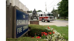
The Orchard Park, NY, Fire District is integrating 3AM Innovations' AI-enabled incident command platform, FLORIAN, into their daily operations.